Drones: Delivering Centimeter-Level Accuracy through RTK Technology
By JEFF FARR
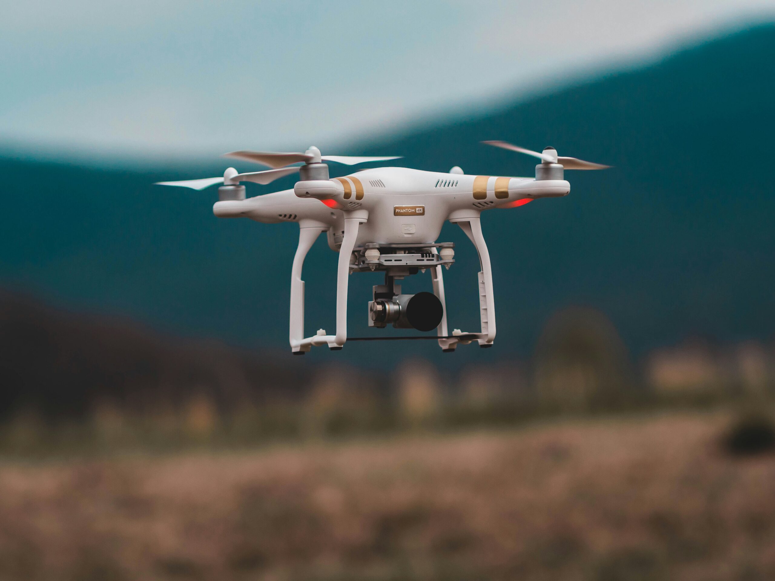
Think about having a team member who can get to the most dangerous parts of your jobsite, collect thousands of data points with centimeter-level accuracy and do it all in a single afternoon.
That’s not science fiction; that’s the reality of modern drone inspection services. We’ve moved way past simple flyovers. This is about deploying highly specialized tools for critical asset management.
The New Standard for Site and Asset Management
Drones, or unmanned aerial vehicles (UAVs), are completely changing how projects get done – especially in industries like construction, engineering and land development. When you equip them with high-resolution cameras, thermal sensors and LiDAR, you get a safer, faster and far more accurate way to monitor progress, manage assets and ensure compliance from the first day to final sign-off.
From Pictures to Precision Data
The real value here isn’t just getting a bird’s-eye view. It’s about creating a verifiable digital record of your site at a specific moment in time. This “digital twin” becomes an absolutely essential tool for making smart decisions.
Instead of relying on slow, error-prone manual measurements or random spot checks, drone data gives you comprehensive site coverage. For a project manager, this means you can:
- Verify work completed against design plans with incredible accuracy.
- Calculate material stockpiles for spot-on inventory and budget control.
- Identify potential safety hazards before they turn into real incidents.
- Communicate progress to stakeholders with clear, undeniable visual evidence.
At its heart, a drone inspection delivers certainty. It replaces assumptions and guesswork with precise, geolocated data, allowing your team to build with confidence and shut down disputes before they even start.
Real-World Impact on Complex Projects
The practical applications are already proving their worth on massive builds. Take, for example, our ongoing contract with Mortenson Construction for the new Meta data center in Eagle Mountain, Utah. A project of this scale demands exacting standards for tracking progress and ensuring quality control.
By using regular drone inspections, the Mortenson team gets a consistent, data-rich overview of the entire site. It allows the team to monitor earthwork, verify utility placements and document construction milestones with a level of detail that traditional methods just can’t touch. This is a perfect real-world example of how drone inspection services have become a non-negotiable part of modern construction management, providing the clarity needed to keep complex projects on schedule and on budget.
How Drone Inspection Technology Actually Works
To really get why modern drone inspection services are so valuable, you have to look under the hood. These aren’t just flying cameras; they’re incredibly sophisticated data collection platforms built on several interlocking technologies. Each piece of the puzzle plays a specific role – and when they work together, they turn raw aerial images into measurable, actionable intelligence for any construction or engineering project.
It all starts with capturing data, but not just any data – it has to be geographically accurate down to the centimeter. From there, thousands of individual images are processed into one seamless digital model. Finally, intelligent software scours this model to find what the human eye might miss, making sure nothing critical gets overlooked.
Achieving Survey-Grade Accuracy with RTK
The foundation of this precision is Real-Time Kinematic (RTK) technology. Think of it this way: standard GPS can tell you which street you’re on, but RTK can tell you which specific crack in the sidewalk you’re standing on. It’s an ultra-precise positioning system that corrects for the small atmospheric errors that normally throw off GPS signals.
An RTK-enabled drone is in constant communication with a stationary base station on the ground, which has a known, fixed coordinate. By comparing its own location data against the base station’s, the drone makes real-time corrections on the fly, achieving centimeter-level accuracy.
This is what turns a simple flyover into a professional survey tool. It completely removes the need to place dozens of ground control points across a jobsite – a process that eats up time and labor. For massive projects like the Meta data center in Eagle Mountain, which Earth Mappers is mapping for Mortenson Construction, this level of accuracy isn’t just nice to have; it’s non-negotiable for proving that as-built conditions perfectly match the engineering plans. If you want to dive deeper, you can learn more about the superiority of drone-mounted RTK modules in our detailed guide.
Building a Digital Twin with Photogrammetry
Once the drone captures hundreds or even thousands of high-resolution, geotagged images, the next step is photogrammetry. At its core, this is the science of making measurements from photographs. Specialized software gets to work analyzing all the images, identifying common points and features across them to calculate depth and dimension.
Imagine building a perfect Lego model of your entire construction site. That’s exactly what photogrammetry does, but digitally. It stitches the overlapping photos together to create two main deliverables:
- Orthomosaic Maps: A single, high-resolution, geographically correct aerial map of your site, completely free of distortion.
- 3D Models: A detailed, measurable three-dimensional replica of the site and its structures.
These aren’t just pictures; they are data-rich digital twins. Project managers can use them to measure distances, calculate stockpile volumes, track progress against design files and perform virtual site walkthroughs right from their desks.
AI-Powered Analysis for Deeper Insights
The final layer is AI-assisted anomaly detection. A 3D model is an amazing tool, but manually inspecting every square inch for defects is nearly impossible on a large scale. This is where artificial intelligence steps in, acting as a tireless digital inspector that never needs a coffee break.
AI algorithms can be trained to recognize specific issues relevant to your industry. For instance, an AI model can scan a building’s facade and automatically flag things like:
- Cracks in concrete
- Signs of water intrusion
- Corrosion on steel beams
- Missing or damaged components
This automated process massively speeds up inspection workflows and slashes the potential for human error. AI doesn’t get tired or distracted; it methodically scans the entire dataset and generates a detailed report of potential issues that need a closer look from a human expert. It’s this combination of RTK precision, photogrammetric modeling and AI analysis that makes professional drone inspection services such an indispensable tool for modern asset management.
Real-World Applications of Drone Inspections
The true value of drone inspection services really clicks when you see them solving real-world problems. It’s one thing to talk about the tech, but it’s something else entirely to see how it helps contractors and engineers on the ground. From massive construction sites to sprawling solar farms, drones are providing a level of operational intelligence that was simply out of reach before.
This isn’t just a fleeting trend; it’s a fundamental shift in how industries handle risk, safety and efficiency. The global market for drone inspection and monitoring shows just how big this shift is, projected to jump from $15.5 billion in 2025 to an incredible $36.94 billion by 2030. This explosive growth is driven by industries wisely moving away from dangerous manual inspections. Drones can safely get eyes on power lines, complex structures, and other hazardous areas without putting a single worker in harm’s way. You can dig deeper into the growth of the drone inspection market to see the full picture.
Construction Progress Monitoring
For any general contractor, keeping a complex project on schedule is everything. The old ways of tracking progress – walking the site, taking photos from the ground – are slow and never quite capture the full picture. This is exactly where drone inspection services shine.
With regularly scheduled flights, often weekly, drones capture a complete snapshot of the entire job site. The orthomosaic maps and 3D models created from this data become a living, time-stamped record of progress. Project managers can then overlay these models with BIM or CAD files to see, instantly, if the work on the ground matches the design plans.
This approach also transforms how materials are managed. Instead of relying on rough estimates, drones deliver highly accurate stockpile volume calculations. This means you know exactly what you have on site, preventing the kind of costly budget surprises no one wants.
Data Center Construction Verification
Building a data center is all about precision. Every single component, from underground utilities to structural steel, has to be perfectly aligned. The sheer complexity of these projects leaves zero room for error.
On a site of enormous scale, you can’t afford guesswork. Drones equipped with RTK technology are indispensable, providing the centimeter-level accuracy needed to verify that everything from concrete foundations to underground conduits is installed exactly to spec. This digital verification catches small deviations before they become big, expensive problems.
For mission-critical facilities like data centers, drone inspections are not just about progress tracking – they are a core part of the quality assurance workflow, ensuring every phase of construction meets exacting standards.
Solar Farm and Utility Inspections
Maintaining vast energy infrastructure has always been a logistical beast. Sending crews out to manually inspect thousands of solar panels or hundreds of miles of power lines is slow, dangerous and incredibly expensive. Drones completely flip that script.
A drone carrying a thermal camera can fly over a solar farm spanning hundreds of acres and pinpoint underperforming or faulty panels in a single afternoon. The thermal sensors spot temperature differences that signal a defect, allowing maintenance teams to go straight to the problem instead of searching for it.
It’s a similar story for utilities. Drones capture high-resolution imagery of power lines and transmission towers, inspecting hardware components without forcing a shutdown or sending a technician up a tower. They can easily spot issues like:
- Damaged insulators
- Corroded hardware
- Vegetation getting too close to the lines
This proactive approach to maintenance helps prevent catastrophic failures and keeps the power grid running reliably.
Building Facade and Roofing Inspections
A building’s exterior is its primary defense against the weather, but inspecting it has always been a pain. It meant bringing in scaffolding, lifts or rope-access teams – all of which are expensive and create significant safety risks. Drone inspections provide a much safer, faster and smarter way.
Drones can fly a systematic pattern to capture thousands of high-resolution photos of a building’s facade and roof. Photogrammetry software then stitches these images together into a highly detailed 3D model. From the safety of their office, engineers can conduct a virtual inspection, zooming in on potential trouble spots like cracks, water intrusion or spalling concrete. This gives them a complete, detailed picture of the building’s condition, leading to much better-informed maintenance decisions.
Seeing It in Action at the Meta Data Center
Technical specs and abstract ideas are one thing, but seeing drone inspection services solve real problems on a massive, high-stakes project truly brings their value to life. Let’s shift back from theory to a real-world scenario happening right now: that sprawling Meta data center construction site in Eagle Mountain, Utah that we referred to earlier. This isn’t just another big job; it’s a multi-phase campus where precision is everything and a single delay can have huge financial consequences.
For general contractor Mortenson, a site this big presents some serious logistical headaches. The GC is up against aggressive timelines and incredibly high quality standards, so it needed a way to get a constant, reliable and dead-accurate view of progress across the entire site. Traditional surveying methods, while accurate, would simply be too slow and require too many boots on the ground to keep up with the daily pace of change.
This is the exact point where professional drone services go from being a “nice-to-have” gadget to a mission-critical tool.
Deploying Precision Drone Technology
To hit the project’s demanding specs, we put our RTK-enabled drones to work, flying the site every single week. RTK technology gives us that crucial centimeter-level accuracy without needing to set up tons of ground control points – a huge advantage on a busy, ever-changing construction site. Week in and week out, our pilots fly a pre-planned route, capturing thousands of high-resolution, geotagged images that cover every square inch of the project.
This raw data is then processed into two key deliverables:
- Hyper-Accurate Orthomosaics: Think of this as a single, perfectly flat aerial map of the whole site. It’s a flawless visual record of progress at a specific moment in time.
- Detailed 3D Models: These are interactive digital twins of the site. Project managers can spin them around, view them from any angle, take precise measurements and compare what’s been built against the original designs.
These deliverables quickly became the single source of truth for the entire project team, giving them a solid foundation for making critical decisions.
From Data to Decisions
For project managers, these data-rich tools completely change day-to-day workflow. The weekly models and maps aren’t just for looking at – they are actively used to push efficiency and lock down quality control.
For a project as complex as a data center, the ability to perform precise cut-and-fill calculations for earthworks is a game changer.
Calculating the ROI of Drone Inspection Services
So, how does putting money into professional drone inspection services actually show up on your bottom line? This isn’t just another operational expense. It’s a strategic move that delivers a powerful return by making your team more efficient, directly cutting costs and seriously boosting safety. The first step is to build a clear business case by looking at these advantages in real numbers.
The most immediate and obvious return is in direct cost savings. Just think about the old-school ways of inspecting a multi-story building facade, a cell tower or a massive construction site. These jobs usually demand expensive scaffolding, teams of rope access specialists or even helicopters – all with huge price tags and logistical headaches.
Swapping those manual methods for a drone immediately wipes those big line items off your budget. We’re not talking about minor savings here. This can easily be the difference between a profitable project and one that just scrapes by. This is where the ROI calculation really starts, with clear, hard numbers.
Gaining an Edge with Unmatched Efficiency
Beyond the direct savings, the gains in efficiency add another powerful layer of value. Traditional inspections are notoriously slow. A crew might spend days just setting up equipment and conducting a manual survey that a drone can knock out in a few hours. That speed creates a ripple effect across the entire project.
Drone inspections are absolutely slashing the time wasted by older methods, often cutting inspection times by up to 80 percent and bringing down operational costs by as much as 75 percent. For contractors and utility companies managing huge infrastructure, sending crews up towers or across bridges means delays, danger and big expenses. Drones flip that script entirely, capturing high-res imagery and LiDAR data in a tiny fraction of the time.
For Earth Mappers’ clients in surveying and engineering, this means getting precise photogrammetry for topo maps and progress tracking without the grind of traditional groundwork. You can discover more about these efficiency gains and how they’re shaking up the market. Faster data means less downtime for critical assets and tighter project timelines.
The Invaluable Return of Enhanced Safety
Finally, and most importantly, let’s talk about the return on safety. The single most effective way to prevent accidents is to keep your team out of dangerous situations – whether that’s working at height, near live power lines or on unstable ground.
A drone-first inspection policy isn’t just about checking a compliance box; it’s a fundamental commitment to protecting your people. This significantly reduces your liability, lowers insurance premiums and fosters a stronger safety culture within your organization.
How to Choose the Right Drone Service Partner
Picking a drone service provider is one of the most important calls you’ll make on your project. Get it right, and you’ll get actionable data that saves time and money. Get it wrong, and you could be left with a folder of pretty but useless pictures. Not all drone companies are built the same, so you have to do your homework.
You’re not just hiring a pilot; you’re looking for a partner who can act as a true extension of your team. They need to get the specific demands of your industry. A provider with a deep portfolio in construction and engineering will understand why survey-grade accuracy is non-negotiable. That’s a world away from someone who primarily shoots real estate photos. Industry experience means they speak your language and know what data actually matters to you.
Essential Qualifications and Credentials
Before you get into the nitty-gritty of your project, cover the basics. The absolute starting point is confirming any potential partner holds a current FAA Part 107 certification. This is the legal license to fly drones commercially in the U.S. and the first sign of a professional operation. No Part 107, no conversation.
Next, ask to see the operator’s safety program documentation. Any serious company will have a detailed, written safety manual and a clean track record it can prove. This is more important than ever as the industry expands, with North America grabbing 34.72 percent of the global market share in 2024. As the FAA moves toward standardizing beyond-visual-line-of-sight (BVLOS) flights, a deeply ingrained culture of safety is what separates the pros from the amateurs. You can read the full research on drone inspection market trends to see where things are headed.
Verifying Technical Capabilities and Deliverables
Once you’ve confirmed the drone operator’s credentials, it’s time to talk tech. The gear it flies is a direct impact on the quality of the data you receive.
A critical question is what’s in its fleet. Is the firm flying enterprise-grade drones with RTK or PPK capabilities? That technology is the difference between a simple aerial photo and a survey-grade, measurable asset you can build from.
Finally, get crystal clear on what the operator will be handing over. The best pilot in the world is no good to you if his or her data doesn’t plug into your team’s workflow. Be specific about what you need:
- File Formats: Can they deliver LAS point clouds, GeoTIFF orthomosaics or OBJ 3D models that are ready for your software, whether it’s AutoCAD, Civil 3D or Procore?
- Turnaround Time: What’s their typical timeline for processing and delivery? For tracking job progress, you need a partner who can hit a weekly or bi-weekly deadline without fail.
- Data Hosting: How will you get the files? Do they provide a secure, cloud-based platform where your team can easily view, share and download the models and reports?
Answering these questions will help you find a partner who is both capable and reliable. For a bit more guidance, take a look at our article on the top 10 reasons to utilize a professional drone service company.
Jeff Farr is founder and CEO of Earth Mappers, LLC.
View Our Latest Print Edition

Fresh Content
Direct to Your Inbox